Thursday, October 1, 2009

Guide to Waterproof Jackets

With the cool fall weather, many people are finally able to go outside and take a hike. Some of you may be planning to take a trip or trek during autumn, and the one item that is essential during this time of the year is a reliable waterproof jacket. As a frugal backpacker and hiker, I can tell you from experience that a trash bag or poncho just does not work. They make you sweat like nothing else and provide little warmth in the winter- not to mention they puncture easily! Likewise, a Walmart jacket will not serve you any better, especially if you sweat a lot. Taking the time to find a good quality jacket will reap its rewards tenfold when you are out on the trail trekking through a fall storm but remain dry.

Webtogs (outdoor gear specialist) has recently launched a video guide to waterproof jackets. The host explains the most important aspects of a waterproof jacket that need to be considered when making a purchase. Since not all outdoor activities are the same, not all waterproof jackets can be treated alike either. This stress on what type of activity you will be engaging in while wearing the coat is essential, because it determines what you need. For example, a hiker will benefit from a long coat while a climber will need a small coat that is close to their body so that movement is not restricted.

Some other elements discussed in the video include:
  • Fabric- Why it makes a difference and what to look for. You don't want to be sweating like a pig! Look for membrane that lets water vapor through but stops the rain from coming in.
  • Features- What to look for in hoods, zippers and pockets. Since fall temperatures can fluctuate, a good pit zip should also be considered to allow airflow into the jacket while blocking most of the rain. I loved the idea of making sure you have a front chest pocket to store your map in!
Although buying quality gear can be more expensive, it's certainly worth it in the long run. When you're climbing the Appalachian Mountains and are caught in a downpour, you'll see what I mean. You can't put a price on dryness in the back-country! As I've said before- "Good gear is gear that you can count on even in the worst of times".

For more gear reviews, click here.

Tuesday, September 29, 2009

Fall Hiking and Backpacking in the Cincinnati Area

Now that fall has arrived, hiking and backpacking are back on the agenda again! With the cool weather and beautiful foliage of the trees, fall is the perfect time to get out into the woods before the cold settles in for good. Thinking about planning a hike or an overnight trip? Here are some great ideas to help get you started.
  • Mt. Airy Forest (OH) - This municipal forest, one of the largest in the country, has several trails worth trekking. Perfect for a free afternoon or weekend outing.
  • Hueston Woods State Park (OH) - Situated around a reservoir, this park has several trails fitting for fall day hikes. The colors of fall are most attractive next to the scenic lake.
  • East Fork State Park (OH) - Only a 30 minute drive from Cincinnati, this park is centered around a reservoir. Although the forest is young, a large network of hiking and backpacking trails exist. If backpacking for one night, there are several camps available with 3-walled shelters.
  • Caesar's Creek State Park (OH) - Travel north on I-71 to Caesar's Creek, a state park situated around a reservoir less than an hour's drive away. The park is large and the hiking opportunities are numerous. Backpacking options also exist, but camping is limited. Beautiful scenery and great terrain.
  • Twin Valley Metro Park (OH) -Located near Dayton, this metropark recently opened a backpack trail perfect for those last minute getaways.
  • Shawnee State Forest (OH) - If you want challenge, this is the place to be. Although views and scenic areas are limited, the backpack trail is the best in the state and can be traversed in one large loop or two small loops. Best for multiple night trips. (special notice)
  • Knobstone Trail (IN) - This trail is best for overnight backpacking trips, but must be done as either an out and back or with two cars. The knobstone rivals Shawnee's terrain.
  • Red River Gorge (KY) - A favorite for Cincinnati hikers and backpackers for years, Red River Gorge, located in the Daniel Boone National Forest, is the perfect place to catch fall foliage. If you're into rock climbing, this is the spot to experience some of the best in the country. Since RRG can be crowded on the weekends, plan an overnight trip during the week for optimal solitude.
  • Cave Run Lake (KY) - Slightly north of RRG, Cave Run Lake offers several hiking trails that can easily be made into overnight treks. Catch the Sheltowee Trace Trail nearby, visit the site of an old fire tower and camp by a lake with open skies.
  • Mammoth Cave National Park (KY) - As a three hour drive, it's definitely not a day jaunt but perfect for overnight and multiple day treks. The terrain is varied, but never too strenuous. A variety of trails intertwine allowing you to choose your own route. Some trails are frequented by horses, so watch your step! Camping opprotunies abound, many in very scenic locations. After you've had your share of the forest, explore one of the many underground cave systems the park was made for.
  • Great Smoky Mountains National Park (TN) - For high wilderness adventure, it doesn't get any better than at GSMNP. As the second closest national park to Cincinnati (a 5 hour drive), it makes the perfect weekend getaway for the hard-care backpacker or hiker. However, remember to bring a bear bag and rope!
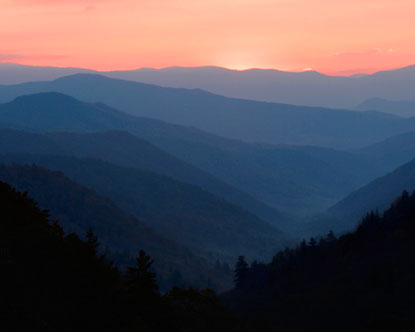
*Photos by Rachel Campbell; Left: Hueston Woods State Park/Right: Mammoth Cave National Park

Wednesday, September 23, 2009

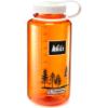
My Review of REI Nalgene Everyday Wide-Mouth Loop-Top Tritan Water Bottle - 32 oz.

Originally submitted at REI

Guaranteed leakproof, this REI wide-mouth water bottle in fun transparent colors is a must-have for camping or campus!


Best Hiking Water Bottle around!

By Chiliman from Ft. Thomas, KY on 9/23/2009


5out of 5

Gift: No

Pros: Slim Design, Impact Resistant, Good Capacity, Retains Temperature, BPA Free

Best Uses: Backpacking, Gym, Camping, Everyday, River Trips, Hiking

Describe Yourself: Avid Adventurer

This bottle is the best thing on the market. It fits perfectly into nearly every backpack's bottle holders. This bottle retains the temperature of its contents very well, and does not suffer under brutal impacts. In addition, they have set the standard for the looks of water bottles.
Other imitations try to make cool designs, and use metal materials that dent when they are simply bumped into, but not the Nalgene! I have dropped them off the side of the mountain, and yes they survive without any damage.
When shopping for the right bottle to take with you on the stroll, to work, on a wilderness adventure, go for the Nalgene.

(legalese)

Friday, August 14, 2009

Leki Trekking Poles Review


If you hike a lot, chances are you've either come across others using trekking poles on their hike or you may utilize them yourself. I'll admit, when I first saw others using them, I thought- How dorky! Who would want to use ski poles to hike- haven't they ever heard of hiking sticks?! But as I hiked more and more, I started to see the advantages of using trekking poles.

They provide better footing, transfer some of the weight off your back, are easier on your knees and can aid in hiking over slippery or steep trail.

When my husband bought me my Leki trekking poles for my graduation present, I was excited to finally try them out. When I did, I was astounded I did not want them sooner! I felt like I was flying down the trail with those poles! My husband commented that I hike much faster and more confidently than I ever did before. Now, I won't go anywhere without them :-).

LEKI Luau Trekking Poles - Women's

These beauties are the best thing since sliced bread (ok, maybe just the best thing since hiking poles came out). What I love about my pair is that they are tailored to women (complete with a cool luau design). They are easy to close and adjust and sturdy (they don't ever collapse on me). Best of all? LIFETIME warranty. Meaning if you ever do manage to break these suckers, Leki will replace them for you free of charge!

My husband paid over a hundred dollars for my poles, but right now they are on sale at amazon.com for only $70! That's like over 40% off the original price. I am a little mad mine cost so much more, but that's what happens when new and exciting gear comes out.

Click here to snag this amazing deal!

Friday, August 7, 2009

Boy Dies In Death Valley National Park


Many times, our technology can give the false illusion of safety. Increasing numbers of people have started to rely on GPS units in the back-country and for navigation. Although this can be a handy tool, basic map and compass skills are still a vital and necessary asset for survival.

This Fox News article, covers the recent death of an 11 year old boy who died from dehydration in Death Valley National Park. The story quotes:

An 11-year-old boy died in the intense heat of Death Valley National Park after he and his mother became stranded in one of the world's most inhospitable areas and survived for several days on bottled water, Pop-Tarts and cheese sandwiches, authorities said Friday.

Alicia Sanchez, 28, was found severely dehydrated and remained hospitalized in Las Vegas a day after being found with her dog, her dead son and a Jeep Cherokee buried up to its axles in sand.

She told rescuers in California's San Bernardino County that her son Carlos died Wednesday, days after she fixed a flat tire and continued into Death Valley, relying on directions from a GPS device in the vehicle.

The story goes on to say that

"A GPS does not replace a map, a compass, checking in at the visitor center and letting people know where you're going to be," Pennington said.

He said searchers mistakenly looked late Wednesday for Sanchez in campgrounds in the Panamint Mountains, based on family members' reports that she planned to camp in free sites and visit the Scotty's Castle attraction in the far northeast corner of the vast national park.

This story illustrates how vital it is to take precautions while traveling in the back-country. Always let someone know your itinerary and check in with officials before starting out. Always carry a map and a compass. You never know what will happen in the back-country wilderness. Do not rely on technology to save you. Rely on yourself.

Be prepared and give the wilderness the respect it deserves. To read about how you can hone your back-country skills if you become lost, click here. We've had some close calls ourselves.

Marmot Mica Jacket Review

Rain gear is an essential item for the backpacker. Although there tends to be quite a bit of opinion regarding what is the best option for rain gear, there is no doubt that it plays a pivotal role for the hiker who is trudging through the wet forests of the eastern US. Key considerations when choosing rain gear are weight and breathe-ability. Many lightweight backpackers often find a hard time finding a nice medium of both.

Enter the new Marmot Mica Jacket. A wonderful melting of breathable waterproof fabric that's completely lightweight. And it's not just lightweight- it's comfortable. The softness of the jacket makes it easy to wear even if only a slight drizzle interrupts your hike.

Not convinced? How about a video showing off it's greatest assets? The Webtogs video review of the Marmot Mica Jacket (for men) gives you a short and informative high-quality overview of the jacket from a hiker's point of view. You'll get to see this jacket in motion as a member of the Webtogs team explains the specs in detail.

Highlights of the Marmot Mica Jacket:
  • Lightweight (bulkiness cut down through use of waterproof seaming)
  • Breathable (constructed of MemBrain Strata fabric)
  • Adjustable (velcro cuff, elastic draw cords)
  • Zippered pockets
The woman's version is similar, but it is known as the Marmot Crystalline Jacket, although the basic specs are the same. This jacket definitely stands up on the list of high quality rain gear. It's tough and it's rough and it will get you through any type of rain from downpour to drizzle, keeping you dry and comfortable along the way. And weighing in at only 7 oz., it's a lightweight and ultra-light backpacker's best bet.

Although buying quality gear can be more expensive, it's certainly worth it in the long run. When you're climbing the Appalachian Mountains and are caught in a downpour, you'll see what I mean. You can't put a price on dryness in the back-country! As I've said before- "Good gear is gear that you can count on even in the worst of times".

To read Cincinnati Hiker's Berghaus hiking boot review, click here. To watch more videos produced by Webtogs, click here.

Wednesday, August 5, 2009

Storing Hiking and Backpacking Gear Effectively

Whenever I get ready for another hike or another backpacking trip, I seem to scurry around like a mouse for an hour or two, gathering all my gear and checking off my list, afraid of forgetting something. After our last backpacking trip, however, we have devised a simple system to make getting ready for trips easier and smoother. And the less time it takes to get ready, the more time spent hiking or on the trail!

Hang a "Master List" in the closet that holds your gear.

We decided to print ours out and laminate it, that way we can cross off things we have with a marker and wipe it clean for next time. This is a great time saver, since we don't have to hunt down where the list is- it's already there! Make a checklist for day hikes and backpacking trips and categorize them by seasons. Since hiking in the winter requires additional gear, have a separate list for it.

RePack each backpack at the end of each trip, leaving out only food, water, toiletries and clothing.

This saves a huge amount of time. Wash everything that needs to be immediately after each trip and repack. Make a separate list of items that belong in the pack permanently. Make sure to leave out items like sleeping bags so that they don't loose their fill, especially if they are down. Now all you need to do for the next trip is grab and go!

Sort through gear at the end of every trip and re-evaluate.

Determine at the end of each trip, when your memory is the freshest, whether you needed or used a particular item. If it's not one of the 10 essentials and you don't use it, toss it. This helps to bring down over-all pack weight over time. Make a list of items that need replacing and repairing as well, such as first aid items that were used or a broken tent zipper. If you don't do it now, chances are you will forget and have trouble during your next trip.

These system has worked out great so far, and I cannot imagine going back to my former scurrying!

Do you have a system/strategy when it comes to storing gear for the next trip? Share in the comments below!

Wednesday, July 29, 2009

My Review of Therm-a-Rest Trail Pro Sleeping Pad - Regular

REI

This Therm-a-Rest brings together a perfect harmony of light weight, cushioning and durability for the ultimate in sleeping bliss, night after night.


Wonderful Cushion

Chiliman Cincinnati, OH 7/29/2009


4 5

Gift: No

Pros: Lightweight, Easy To Inflate, Non Slip, Comfortable, Durable Design

Cons: Bulky Roll Up

Best Uses: Weekend Trips, Car Camping, Backpacking, Extended Trips

Describe Yourself: Avid Adventurer

What Is Your Gear Style: Minimalist

The trail pro provides comfort without sacrificing weight. I actually feel like I am on a bed when laying on it. Before buying it, I tested it out on hard concrete floor with various items underneath to simulate sticks and rocks, and I didn't feel a thing.

Although it does not come with its own stuff sack, I've found this isn't really necessary. You can easily purchase a cheap sack for it. I simply stuff mine in my backpack.

Sleepless nights in the back-country have kept me from going out more often, but now that I have the trail pro, I will be hitting the trail more often!

All in all, worth the weight, worth the price.

()

Saturday, July 11, 2009

60 Hikes in 60 Miles: Cincinnati - Review

Finally, a Cincinnati hiking guidebook that brings together the best hikes less than an hour's drive away. Tammy York teamed up with the series 60 Hike in 60 Miles to produce one of the area's most long awaited reads. Here's my review on the book.


Tammy York does a good job of gathering information about some of the area's more obscure trails. Another great thing about this book is that she does not solely fill it with one or two mile treks like many other metro focused hiking books. Instead, you'll find walks and hikes anywhere from 13 miles to the occasional 1 (albeit a good one mile!). Many of the hikes I have personally not heard of, and so for this very reason this book is a great buy for any local hiker.

Downsides? The author is more of a leisurely hiker than an avid outdoors woman. And so her description of the trails and the hikes reflect this. Don't pay much attention to her difficulty rating if you backpack regularly or like a diverse terrain. Also be sure to double check driving times and distances. I don't think she uses the downtown metro area as a starting point for many of her hikes (for example, there was a hike in Ft. Thomas that was described as being 30 minutes away. As a resident of the town, I can assert that this is incorrect for it is merely a 5 minute drive from downtown). Don't expect to find any backpacking trails in this book either.

Aside from its shortfalls, 60 Hikes in 60 Miles is still a good read or at least a handy book to have for quick reference if you're searching for hiking trails near Cincinnati.

Thursday, July 9, 2009

Explore the National Parks with Experienced Guides


If you've been looking for the best guide to the national parks, look no further. Team KANGA seeks to empower and guide more individuals and families toward adventure in American's National Parks while cultivating a love for the outdoors. Their guides are the most exclusive and comprehensive of any DVDs covering the National Parks. With a focus on hiking and adventure within the parks, they offer a unique perspective on trip planning.

What makes these guides worth considering?
Experience. Team KANGA not only produces the guides, but they are also out testing the trails, researching issues and seeking out the best wilderness adventure experience. You won't find that anywhere else. Team KANGA also prides itself on being the most up to date National Parks DVD, meaning you'll get insight on current issues and conditions.

The best part? They're affordable. Ringing up at just under $10, Team KANGA's DVDs are perfect for recession budgets.

To purchase their top selling exclusive Smoky Mountains National Park DVD Guide, click here.

Tuesday, July 7, 2009

Shawnee Backpack Trail Trip Report

Last weekend we went off on an overnight backpacking trip to Shawnee State Forest. Camp 6 is reputed to being the prettiest campsite in the entire forest, so we set our sights on getting them by nightfall. The camp is located about 10 miles from the trail head and is surrounded by tall pine trees and nestled next to a babbling brook. We passed the campsite on a previous trip, and so were very excited about staying there finally.

After passing up camp 7, we hiked about a half mile or so before reaching a clearing with no marking. Little did we know that we had missed the turn off for the trail a quarter mile ago. Thinking we were still on the trail, we plodded along on the random ATV trail we had been following. An hour went by and there was still no sign of an orange blaze. I started to panic.

How could we be lost? It's definitely something that no one plans on being. It was very easy to miss the improperly marked turnoff, however. I had settled on camping on the rough ATV trail that night (it was growing dark) and filtering water from a small mud stream nearby. Miraculously, we soon emerged out of the humid foliage and found the trail. But there was one problem.

We didn't know which way to go. Studying the map, we tried to determine where we were based on elevation. The forest service maps did not include unmarked ATV routes, so we could not even identify that. Finally, Chiliman determined that we needed to go south and that we needed to turn left in order to do so according to the position of the sun. I thought he was probably right, but I also thought that we should stay low in elevation, which is where the campsite would have been located. We decided to go right.

Two hours later from when we passed camp 7, we arrived right back at camp 7. It was disheartening. We had backtracked terribly, and it was partly my fault for misjudging Chiliman's instinct. The real curplit? Unmarked trail. If you are heading out to Shawnee State Forest to backpack, please note that there is a drastic one-hundred degree righthand turn a quarter of a mile from camp 7 on your way to camp 6. The turn is hidden amongst brush and overgrowth.

Unmarked, improperly marked or even unmaintained trails are easy to get lost on. This was the first time we did not bring a compass with us, and it was the first time we needed it.

To avoid getting lost on a trail, pay attention at all times. Do not move forward unless you see a marker or a blaze indicating the proper direction. We plowed straight ahead on what we assumed was the trail, but it turned out to be a misleading ATV track. This can happen to you too. Be prepared. Bring a map and a compass at all times. If you have a GPS unit, I would bring that too. If you become lost- do not go any further! Backtrack until you find yourself back on the trail or in familiar surroundings.

I hope this helps prepare you either for a trek in Shawnee State Forest, or any other backpacking adventure where backcountry hiking is involved.

Saturday, July 4, 2009

My Review of Therm-a-Rest Z-Lite - Regular

REI

For sleep-anywhere comfort, Z Lite is the lightest, most compact, full-length closed-cell foam pad Therm-a-Rest® makes.

Reliable but not too comfy...


3 5

Gift: No

Pros: Lightweight, Compact Roll Up, Non Slip, Durable Design

Cons: Uncomfortable

Best Uses: Backpacking, Weekend Trips, Car Camping, Extended Trips

Describe Yourself: Avid Adventurer

What Is Your Gear Style: Minimalist

I first switched to the Z-lite after using a blue foam pad for about a year. The difference is amazing, and the z-lite really does give you pretty good comfort for a lightweight foam pad.

However, I am a side sleeper, and this pad just isn't cutting it. I wake up every morning feeling the aches and pains from not only the hike the before, but from sleeping on the ground as well. After you get used to it, it's not too bad, though that is true with most ground sleeping.

I would recommend this pad for those looking for a foam pad. It really is the best out there for ease of use, durability and the orange color helps you stand out in hunting areas. For those wanting an excellent night's sleep, opt for a self-inflating or else bring a bottle of wine!

Wednesday, July 1, 2009

Team KANGA launches YouTube videos

Team KANGA has launched its series of YouTube videos. These videos are centered around hiking and backpacking within America's National Parks. It also focus' on ways to enjoy America's National Parks on a budget. Right now, you can view a few of the videos such as backpacking basics and dangerous scenic byways.


Berghaus Hiking Boot Review


One of the most important pieces of gear that you will need while hiking or backpacking is, of course, your footwear. Boots are what propel you along on the trail and protect your feet and ankles. I currently wear a high rise backpacking boot (it's actually the sturdiest boot made for women) due to an ankle problem, but many people are fortunate to stick with mid-rises.

The boot shown in the photo is the Berghaus Explorer Ridge GTX Walking Boot. What makes this boot a good choice? Plenty of reasons! Here are just a few:
  • Waterproof with Gortex (meaning it's breathable!)
  • Relatively lightweight with a leather upper
  • Tunable lacing system (my favorite feature by far!)
If I were on the hunt for a new hiking boot, I would definitely check these out. Although made in the UK, you can order from Berghaus here. These boots also scale high on the affordability scale, meaning you won't be dishing out your life's savings to get your pair.

Looking for more gear besides boots and footwear? Check out the Berghaus YouTube page. From rain jackets to pants, you can watch video reviews of all their products. The videos are well produced, short and informative. Its like having a personal gear shopper right beside you! You not only get to see all the different angles of the product, but you get firsthand recommendations from real people.

I cannot stress the importance of taking your time to really review a product when shopping for backpacking or hiking gear. Usually, good quality gear is a bit expensive, but the money you pay is money well spent. You certainly don't want to be climbing the Appalachain Mountains and have your boots go sour on you, or worse, watch the tredding completely disappear. Good gear is gear that you can count on even in the worst of times. Check out the return policies for all gear that you purchase, as well as manufactor waranties. For example, we purchased a water filter that broke within a year of use. Since the warranty was five years, we were able to return it and get a new one for no cost!

So, read, reveiw and purchase! And don't forget to check out Berghaus' awesome videos!

Wednesday, May 20, 2009

Tuesday's Trail: Twin Creek Metro Park


Today's trail is located just outside of Dayton and is about an hour drive from downtown Cincinnati. Located in the newly established Twin Valley Backpack Trail, Twin Creek Metro Park is a quaint and enjoyable area full of trails to explore. The largest of the trails, the orange trail, measures about 6 miles in length and traverses through fields and forest in a scenic loop.

The trail is easy to moderate in terrain, with a few challenging climbs and descents. Be sure to wear good hiking boots since mud buildup in some areas is unavoidable. Also bring plenty of sunscreen and water, since about a quarter of the trail is out in open fields. Poison Ivy is abundant in this area of the US, so wear long pants if you have trouble identifying the plant.

Park at the trail head off Chamberlin Rd, and begin your trek by traversing through a natural Ohio prairie. Take the trail leading to the left for a more challenging course with plenty of uphill climbs. Stay to the left at each major intersection to complete the orange trail loop. This park does an excellent job in marking the trail, making it both easy to understand as well as see without imposing too much on the natural habitat. You'll soon descend into the forest where you'll remain for the first half of the hike. Before long, you'll pass a Hopewell Earthwork off a side trail from the main orange loop. Be sure to check it out either at the beginning or end of your hike. The forest is quiet, and you'll likely see several species of birds, squirrels, frogs and perhaps a mouse or two.

Rising out of the forest and passing a horse farm on your right, you'll hike uphill towards the High View picnic area and parking lot. This makes for an excellent rest stop. If you packed a lunch, sit here and enjoy several panoramic views of the countryside. A portapotty is also loacted here should you need it.

Descend back into the forest, continuing on the orange trail to the left. You'll reach the flattest portion of the trail here, which will continue until the end. Paralleling Twin Creek, you'll likely spot the river from time to time as the trail winds through the forest. Coming out into the prarie again, climb another hill or two and you've reached the parking area where you started.

If looking for a loop hike, do the whole orange trail. If you have small children or limited phsyical capabilities, take the orange trail that leads to the right towards High View, then double back on the same portion. For those wishing to backpack, park at the High View parking area, then hike to the backcountry sites just pass the Chamberlin Rd parking lot, circling back the next day to make it a loop.

The Twin Valley Backpacking Trail actually goes through another park besides Twin Valley MetroPark. I'll be hiking the other half soon and will post a review. For a day hike, however, or even a quick overnight getaway, the orange trail certainly is great for the location and variety of terrain. 4 stars.

Sunday, May 10, 2009

Tuesday's Trail: Shawnee Lookout


Located east of downtown Cincinnati is Shawnee Lookout, which is part of the Hamilton County park program. Two short trails wind through this area that are definitely worth checking out.

The Little Turtle Trail is 2 miles long with an easy grade. The wide path makes it ideal for families, small groups or those who desire a brisk stroll. Halfway around the loop is nice rest stop with a bench overlooking the Miami River. 3 stars.

The Blue Jacket trail begins on the opposite side of the parking lot from Little Turtle. This trail is much flatter and shorter- measuring only 1.3 miles. Be sure to bring your camera, especially if you come in the summer. The trail is quite picturesque and makes for a nice romantic hike through both woods and fields of wildflowers. 3 stars.

Also take note to bring money for a parking pass (if you don't already have one), since all Hamilton County parks require them. As of 2008, the price for a yearly pass was 5$.

For directions and to visit the park's website, click here.

Thursday, April 23, 2009

East Fork State Park


One of the best last minute getaways from downtown Cincinnati is East Fork State Park. With more than 46 miles of Backpacking and hiking trails on easy to moderate terrain, there is a little something for everyone.

For backpackers, the 20 mile out-and-back backpack trail provides a horsemen free area that never traverses very far from the lake. On this well marked and maintained trail, you'll likely spot quite a few turtles and deer stumbling across the path. Four primitive campsites exist within the park, with a few good illegal sites scattered between. Each campsite features a privy and 3-walled shelters. Water sources may or may not be nearby, so plan accordingly. A free permit is required and can be found in the park office. The park office also sells trail maps for 2$ that is well worth the cost since the free ones are not very helpful.

The one downside to this trail is that it can be quite busy in the warmer months due to its close location to the city. I would recommend trying to camp on weeknights to avoid crowds. Our last trip to the park was on a Friday night, and we had the unfortunate experience of camping with rowdy teenagers who were eventually escorted out of the park. Bring a cell phone (reception is usually good) and call park authorities if you have trouble.

For hiking, the Steven Newman Worldwalker Perimeter Trail circles the lake and perimeter of the park. With a length of 32 miles, it provides plenty of area for exploration. This trail is shared by horses as well as hikers, so be prepared to yield if any approach.

A good pair of hiking boots would serve well at East Fork, especially in the spring when mud is an issue. The summer is often drier, but since trails often parallel not far from the lake, small plants and brush collect moisture that rubs off onto your feet. If backpacking or hiking for an extended period of time, filter all water accordingly. Also be sure to practice Leave No Trace when using the campsites to ensure that it stays clean, sanitary and safe for future hikers.

Thursday, April 16, 2009

Giving Back by Clearing Out


Yesterday, I was able to participate in a community service day event sponsored by my school (Cincinnati Christian University). The theme of this year's service day was "Going Green", and we helped prepare the Cincinnati parks for summer by clearing out honeysuckle, planting flowers and trees, picking up trash and maintaining trails.

I was fortunate to be a part of the group that cleared out honeysuckle in Mt. Airy for 5 hours! Apparently, there are more than 2000 acres in the cincinnati parks that have been infested with this plant, and it is the goal of the Cincinnati Park Board to clear out at least 100 acres a year. Our group was made up of about 15 people, and we managed to cover around 4-5 acres in the time that we were there. There is still so much work to do, but it was quite rewarding to see how much we really did get done. Nothing like getting dirty in the woods!

As an update on this blog, I have not been able to get out hiking this season yet, which is a shame and quite unusual for me. I do still plan on trying to get Tuesday's Trail updated when possible. In between, be on the lookout for more about the cincinnati parks, hiking and backpacking in general.

Tuesday, March 24, 2009

Tuesday's Trail: Shawnee State Forest


Now that spring has finally arrived and warmer weather has decided to stay, I will be posting weekly on different trails in the tri-state area. Today's trail is the Shawnee State Forest backpacking trail. I love this trail, and it has quickly become me and my husband's favorite place to backpack.

Located in west Portsmouth, OH, it is only a 2 hour drive from downtown Cincinnati, making this the perfect weekend getaway trail. Total mileage comes in around 60 miles, so its perfect for extended trips as well as overnight adventures. The great thing about the trail is that it is a loop, so there's no need to repeat any part of the trail in order to get back to your car. There are 7 backcountry campsites throughout this loop, each located near water sources and a latrine. The trail is marked with orange blazes that are very well maintained. You must complete a backcountry permit if you are camping overnight.

What makes this trail so appealing is clearly the challenge involved in hiking it-- there are many ups and downs with frequent elevation changes of more than 1000 feet. Between campsites number 2 and 3 there is a hill I like to call Devil's Mound. Either way you hike it, it is a beast and will quickly rip your butt into shape if you're not already. Be sure to carry plenty of water at all times while hiking this trail-- you're going to need it!

The Shawnee Backpack trail is not for the faint of heart. It has commonly been referred to as "Ohio's Little Smokies", and I would vouch that describes it pretty well. You need to be prepared and in good shape to hike this trail successfully. If you are, I can guarantee that you'll be coming back for more!

*Photo by Rachel Campbell, Shawnee Backpack Trail 2009

Wednesday, February 25, 2009

Tower Park: Urban Hiking in Northern KY


I live in Northern KY, because to me it offers a sense of serenity that the bustling and hustling of Cincinnati doesn't offer. Imagine my surprise to discover hiking trails within a few blocks of my apartment!

Tower Park in Ft. Thomas
has more than 6 miles of mountain biking trails, but these can be used as hiking trails of course. The terrain is surprisingly rough and rugged, giving you a good workout. You can click here to see a map of the park and its trails (on the left tab, click on MAP). Be sure to bring a compass and a copy of the map if you're heading out for the first time, since the trails are roughly marked and intersect quite frequently. Views of the Ohio River can be seen at several points.

I highly recommend these trails for locals who just need to 'get out there' but don't have the time to drive a couple of hours where the best trails are.

Sunday, February 22, 2009

Backpacking: Knobstone Trail, Indiana


The Knobstone Trail in Indiana has long been on my to-hike list. Coming it at over 58 miles, it really is one of a kind in this area. Many people use this trail as training ground for the Appalachian Trail, so its definitely scoring high on ruggedness. Total elevation gain and loss is over 20,000 feet-- not something you see too much of here in the tri-state area (located between Indianapolis and Louisville). I'm thinking that we'll plan on tackling part of this trail (or all) in the upcoming months.

Downsides to this trail include it being a thru hike, so you really need two cars to get from end to end (unless you backtrack, and that's not very fun!). Water is also an issue there, and you'll have to catche it at the roads it intersects. These reasons alone have prevented me from exploring the area, but hopefully I'll try to overcome them!

Stay tuned for more on this great trail and future trip reports!

Friday, February 20, 2009

Welcome!

This blog will follow my hiking pursuits across the tri-state area as I seek to compile information for my book. I plan on using this blog as a sort of digital data book where I can share about hikes in the area and receive feedback from other hikers as well.

Areas I plan on targeting before May 2009 include:

-Indiana area (Brookville Lake/Adena Trace, Knobstone Trail and any others I learn about)

-Cincinnati parks (Mt. Airy Forest will be my main concern- to this date there is not official map of the trails in the forest. I plan on changing that!)

-Tower Park (Ft. Thomas)

I think this is a reasonable list of goals that will keep my plenty busy in the next couple of months. With the warmer weather coming, it shouldn't be too hard to fit in a hike every so often! I plan on giving mileage information, terrain and park notes and pictures of the area/trail.

Follow me to learn more about hiking and backpacking- you just might discover a love for it yourself!

About This Blog

Lorem Ipsum

  © Blogger templates Newspaper II by Ourblogtemplates.com 2008

Back to TOP